
Hiking The Wolf Lake Trail
April 2026
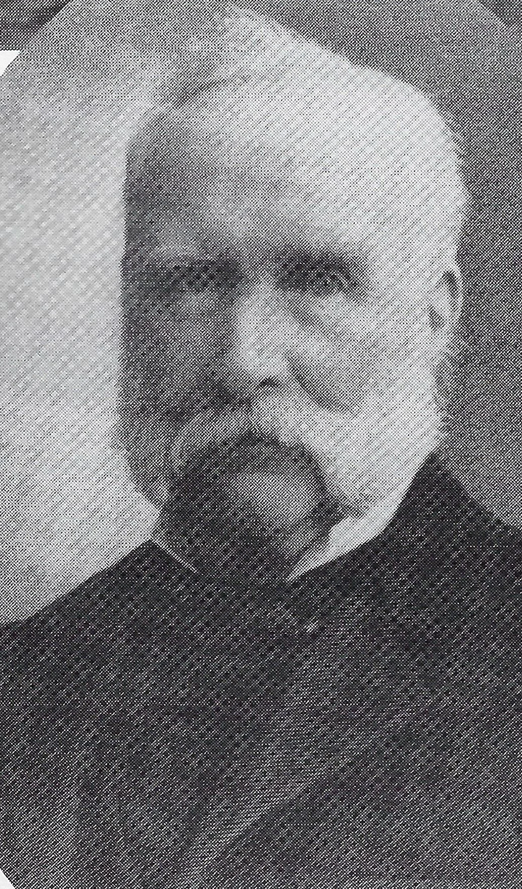
Thomas Vanes
Thomas Vanes is a lifelong resident of Northwest Indiana and a 50-year veteran of its criminal justice system, having served as a prosecutor, defense attorney and judge in the local courts. He is also a 50-year veteran (survivor?) of a marriage to Susan Vanes.
Wolf Lake Trail (Intro)
The patches on my backpack mark trails once hiked in the mountains of Colorado and California. All were breathtaking, literally and figuratively. But with knees that pre-date the advent of power steering, there’ll be no more patches like that in my future. When it came to hiking, it was time to trade alpine terrain for level ground. Time to go local, even if that meant swapping the sight and smell of Western pines for that of Midwestern smokestacks.
I grew up in the Calumet Region during an era when locating a maintained hiking trail meant a trip to the Dunes State Park. Now such trails are everywhere – pick most any federal, state, county or municipal park, or most any abandoned railroad right-of-way. With more to come. And when you walk some of these local trails, there is compensation of sorts for the absence of postcard scenery: You traverse areas rich with the unique history of the Region – a history that is not always pretty and is often more notorious than noteworthy, but one that can be endlessly fascinating.
So a few years back I grabbed the pack and set off with my wife on a series of local hikes, looking forward to some exercise and somewhat fresh air while looking backward in time. Gray Line Tours, self-guided, without the bus.
Journalism, it’s been said, is “the first rough draft of history.” In many instances it is the one and only draft. Newspapers archives going back over 100 years filled in much of what the history books left out and proved to be an indispensable source on Region yesteryears.
When inspiration was needed to keep one foot ahead of the other that, too, was locally sourced. In 1921 a diminutive Whiting pipefitter named Joseph Brenkus made his 7th annual trek on foot to a religious shrine in mid-Wisconsin, and the 51-year-old Brenkus was just warming up. He topped that the following year by walking to New York and on to Jerusalem in the Holy Land, with a boat trip across the Atlantic and an audience with the Pope along the way. And then he walked back.
It is not clear how much good all that mileage did for “Little Joe.” A few years later he faceplanted in an alley, dead from an apparent heart attack. By contrast, our hiking goals were far more, er, pedestrian.
This recount begins with Wolf Lake and the 5.5 mile trail that circumnavigates the Hoosier portion thereof. I knew little about that lake or its environs despite a lifetime here in Northwest Indiana. It seemed little more than a milestone on the road to Chicago. Now I know better.
Part One (Amaizo Channel)
Most of the Calumet Region for much of time was under ice or under water. After the last of the glaciers melted, and as Lake Michigan slowly receded from its high-water mark, left behind at its southern end were sand, swamps, and a series of lakes. The hand of man obliterated some of those meltwater puddles but a large one remains - Wolf Lake, 800 acres of water straddling the Indiana-Illinois line, its eastern half within Hammond and its separated western portion bordering Hegewisch.
The Amaizo Channel, also known as the Wolf River, originally flowed from Wolf Lake to Lake Michigan. This aerial shot shows, at the top of the frame, where Wolf Lake connects to the channel.
We began hiking the Wolf Lake Trail at the parking lot at Calumet Avenue and 121st and headed north alongside the arm of water that extends from Wolf Lake proper toward Lake Michigan. That arm never quite reaches the big lake, stopping a quarter-mile short, and is known as the Amaizo (or Maizo) Channel. But there was a time when it was known as the Wolf River. By definition, a river does not simply stop; it flows into some larger body of water. As did the Wolf River in its day, when it flowed unvexed all the way to Lake Michigan.
A 1941 editorial in The Times mourned what it called “The Late Wolf River” - the “shortest river in the world” which at that point had “only enough water left for a cow to take a bath.” Workmen had been filling it in and with the last shovel of dirt, the “divorce of Lake Michigan and Wolf Lake has been finally consummated.” Who or what instigated that divorce, turning Wolf Lake into the landlocked body of water that it is today and shattering long-held dreams of transforming it into an inland harbor for Great Lakes shipping? Railroads.
Railroads largely made the Region what it is today. The sandy, swampy terrain that deterred early settlement here did not stop the iron horse. And the railroads did not want anything, even the world’s shortest river, to impede their trains as they headed along the southern shore to and from Chicago. So over time they blocked off and filled in the mouth of the Wolf River, once located at what is today the site of the Hammond Marina.
Jacob Forsyth. Is it Forsyth? Or Forsythe? Local historian Archibald McKinlay’s research found that the family spelled their name “Forsyth.” At the park, however, located in the Robertsdale section of Hammond, the name on the sign is spelled “Forsythe,” and that’s the way it’s spelled on a nearby street, and on a square located on the corner of 119th and Warwick. So, the usual use of the name is with an “e” at the end, but the more historically correct spelling is minus the “e.”
Railroad men were uniquely positioned to see economic opportunity in the Region where others saw only sand and swamp. One of the shrewdest was Jacob Forsythe, whose name graces the park that we soon reached on the trail and that sits on his former estate along the eastern shore of the Amaizo Channel.
Jacob and his wife Caroline were the Region’s original power couple. (Shhh - they were also first cousins.) He became known as a “timber and swamp baron” and if you now own property in Hammond, East Chicago or Whiting, odds are that your title traces back to the Forsythes.
Jacob led the legal fight against Hammond’s attempt to annex Robertsdale, Roby and Whiting at the close of the 19th Century. With his money he was able to hire high-caliber legal talent, like former President Benjamin Harrison, to thwart Hammond. After one preliminary court victory, Forsythe threatened to fire off an actual high-caliber weapon – a cannon – to taunt the City. But that thought came to naught when the U.S. Supreme Court proceeded to side with Hammond. By 1931, Forsythe was long dead, all was forgiven, and the City magnanimously dedicated the park in his name.
(Note: It is generally bad news to get written up in the online Urban Dictionary, whose definitions are often not fit to print. Forsythe Park somehow made the grade, albeit in G-rated fashion. An entry therein indicates that the park is erroneously known to many locals as “Four Side Park,” a phonetic mutation of its true name. We were unable to find anyone who could confirm or deny since it was unoccupied on the day of our hike, a shame given how pretty it seemed to be on a gorgeous autumn morning.)
The Region’s onetime status as an unsettled wilderness made it attractive to certain nuisance industries - those that smelled bad (like the Standard Oil Refinery) or those in danger of blowing up (like the former Thearle Duffield Fireworks plant just north of Wolf Lake). On the western shore of the Amaizo Channel, directly across from Forsythe Park and the Wolf Lake Trail, has long sat a corn-processing factory that could do both.
It began in 1906 as the Western Glucose Company and it is currently called Cargill, but its longest incarnation was as the American Maize Products Company, or Amaizo. Hence the name of the channel. A whiff or two of fermenting corn stays in your nose and memory a long time. Amaizo has served as a weathervane of sorts in this part of the Region, as did its longtime industrial neighbors like Standard Oil and the soap maker once called Lever Brothers. To borrow from songwriter Bob Dylan, you didn’t need to be a weatherman to know which way the wind was blowing in these parts. The smell of corn, sulfur and soap became olfactory points of the compass. But there was little-to-no smell on the day we hiked, even downwind of the plant - hopefully the rule these days and not the exception.
Raymond Daly, plant manager of Amaizo, is on the right. On the left is the postmaster of the Roby post office, Ray Austgen. Facing him is the U.S. Postmaster General, James A. Farley.
The growth of Amaizo in the first half of the 20th Century coincided with a paternalistic streak in American industry. Employers sought to provide workers with benefits beyond wages and a life beyond the job. Amaizo followed suit, becoming - in the words of one Times headline – “as much a family as a factory.” Big Daddy in this particular family was a burly Irishman named Raymond Daly. His decades-long reign as plant manager saw the provision of insurance benefits, recreational facilities, movie nights, Christmas parties and summer picnics for his employees.
A Times article from July of 1940 summarized one of these Frolics, as those picnics were known. It now offers an uncomfortable peek into the Zeitgeist of that era. 750 workers paraded past the reviewing stand occupied by corporate bigwigs from New York and Chicago. The intra-plant baseball game was notable because the “colored All Stars beat the regular Amaizo nine” for the first time in history. Dancing followed the athletic events, with music provided by Amaizo’s band – one “selected entirely from the colored employees of the company.”
Walter Mays and his Amaizonians. Photo courtesy of the Temposenzatemp blog, from the collection of Mike Brubaker.
Variously called the “Amaizo Nighthawks” or “Walter Mays and his Amaizonians,” the band was a signature Daly creation. Mays, an accomplished black jazz musician from Chicago, was imported to direct the musicians and to “teach colored men in the plant who wished to study some band instrument.” The band performed decked out in snappy blue and gold uniforms with berets, with Daly sporting a beret himself whenever it played at company functions. And while there were road shows in Michigan and Chicago, Daly could never convince officials in Whiting to allow the band to participate in the city’s parades.
This paternalist impulse was fueled by a mixture, in unknown proportions, of genuine benevolence (albeit a bit patronizing) and corporate self-interest. Industry needed to foster loyalty from workers in order to keep the ones it had and counteract turnover, not all of which was voluntary. Grain dust is highly combustible. Times articles reporting explosions at this facility – and the deaths and injuries attendant thereto – appeared in 1908, 1909, 1910, 1927, 1956, 1976, 1980 and 1988.
Industrial deaths can be horrific. One skin-crawling, cringe-inducing accident from 1927 involved a young worker – killed after just three weeks on the job at Amaizo - whose apron got caught up in the plant’s machinery. The Times reported that “every bone in his body was broken.”
Which prompts a thought: Is there a monument, museum or memorial of any kind – not just local but national – that honors the thousands upon thousands of workers who’ve died over the years in industrial accidents? And if not, could there a better place for one than the Calumet Region?
The photo in the foreground by photographer Matthew Kaplan.
To grow up here was to grow accustomed to the odor of sulfur from refineries and coke plants, the staccato rhythm of banging freight cars as trains were bunched up or stretched out, and the image of rusting metal under gray skies. There’s not much any artist could do to take the edge off what you smell or hear in this area, but a talented one can sometimes transform what you see. An artist like Matthew Kaplan.
Kaplan is a Whiting native turned Chicago-based photographer. “Industry & the Calumet Region” is the title of one of his portfolios and it can be (and should be) previewed online. It is a stunning and surprisingly beautiful documentation of what he calls “this signature landscape.” Viewing his images awakens a dormant sense of pride in our place of origin.
A favorite of mine hangs on the wall of the office where I work - a photo of the Cargill facility in winter, at night. Vaporous plumes arc from the stacks, and the plant with its multi-colored lights is mirrored in the icy waters of the channel below. It’s a professional makeover for a factory. But that factory has fed a lot of people over the years – those who consumed its products and via wages to those who made them - so maybe it has earned that makeover.
Part 2 (Roby)
Hammond, like Gary, grew by accretion, by annexing nearby established communities like Robertsdale, the long-forgotten Saxony and Hessville. Perhaps that is why many current and former residents of those cities hold a primary allegiance to the neighborhood and a secondary identification with the city as a whole. I, for example, grew up in Hessville; Hammond was just a place I went to visit on the No. 2 bus.
Which brings us on the trail and in this narrative to another such neighborhood - Roby, at the north end of Wolf Lake along Indianapolis Blvd. It’s as far as you can get into the northwest corner of this state before starting a transition from Hoosier to Illini. Roby’s brief but fiery existence as an independent ended in 1897. It lived on in name and as a small-but-tight community for most of the next century, but now exists more in legend than in fact.
Gone are Roby’s residents, unless you count those who linger too long inside the Horseshoe Casino. Gone is the tiny, stamp-sized Roby post office that once caught the eye of Ripley’s Believe It or Not. Gone is the Roby Tavern, the longtime blue-collar watering hole for residents and nearby workers.
(The demise of that bar triggers a sense of personal loss. I remember heading there for meal breaks [“going to beans,” in railroad lingo] as a summer-help switchman for the Indiana Harbor Belt in the 1970’s. A decade later, it was the final stop on an extended pub crawl up the Boulevard through Whiting and beyond. At least I think it was the final stop. It’s all a bit fuzzy now. It was all a bit fuzzy then.)
What remains of Roby? Well, the area continues to serve the same purpose it always has. What Chicago wants but Chicago lacks, Roby strives to provide: cheaper cigarettes, cheaper gas, big-box stores, fireworks…and gambling.
The 1100 block of the Boulevard where the Roby Tavern once stood is the site of the northern terminus of the Wolf Lake Trail. It’s also the site of the towering sign that marks the Horseshoe’s entrance drive. Standing there to catch our breath – and to “tip a forty” to honor the former tavern - we saw an endless parade of Illinois tags heading into the casino. And everything old is new again.
Chicago hosted the 1893 World’s Fair and prepped for the event by cracking down on vice - a slippery commodity that simply moved east across the border and set up shop in the relative wilderness that was then Roby. Gambling thrived. Soon there were three horseracing tracks in the vicinity, one of which (Lakeside) sat only a few feet this side of the state line.
This newspaper illustration from the 1890s shows what the gambling hall in Roby looked like.
Twenty-five cents bought you a round-trip ticket on express trains running between downtown Chicago and Roby. In 1894 one downstate newspaper labeled the town as a “Hoosier Monte Carlo” hosting “some of the largest gambling establishments to be found anywhere in the United States” with thousands of daily visitors. The gambling syndicate with its long reach grew strong enough to warrant a name - the “Roby Octopus.”
As is often the case when it comes to the Region, the rest of the state soon howled in disgust. One Indianapolis daily wrote of the great scandal “due to the existence…of the town of Roby, the haunt of gamblers and blacklegs, of race-horse touts and thieves, of thugs and hoodlums from Chicago, who ply their trades in defiance of the law.” Downstate Hoosiers took particular offense when prizefighting was added to the entertainment menu.
Prizefighting was illegal at the time, but Indiana law did permit “exhibitions of science and skill.” The boxing promoters, with a craftiness sure to warm the heart of any lawyer, simply re-christened the bouts as “scientific glove contests.” A wooden hexagonal amphitheater seating thousands was built for the events, which in the end displayed little in the way of science or skill.
The Chicago Tribune described one of the inaugural boxers – sorry, scientific exhibitors - as “entirely too slow and clumsy to be of any use to himself or the world at large.” One particularly raucous exhibition triggered a lengthy diatribe in The Indianapolis News describing the evening’s fights – not those within the ring but those between the security guards and the huge mob that tried to crash the gate, a mob it said was comprised of the roughest elements of Chicago’s slums and the wilds of northern Indiana.
The Governor of Indiana eventually sent armed troops (with a Gatling gun) to Roby to reinstate the rule of law. The locals simply laid in the weeds until the invaders went away. In 1895 the Indiana Supreme Court ruled against the boxing promoters and their “glove contests.” Two months later, the amphitheater burned to the ground. Accidentally, of course.
Roby’s isolation on the north end of Wolf Lake made it hard to police, even after annexation by Hammond. The syndicate began to fade, but a scarlet reputation as a wide-open border town remained, something closer to Tijuana than Monte Carlo. In 1913, Chief of Police Peter Austgen issued a promise in The Times to clamp down on Roby inn keepers, vowing publicly there’d be “no orgies and midnight parties” while warning Illinois rowdies to keep to their own side of the state line. It took time but the crackdown held. During that aforementioned pub crawl in the 80’s, every rowdy we encountered was a local, with nary an orgy in sight.
The population of Roby, estimated at close to 1,000 in 1906, dwindled slowly over the years. One of its later residents was Jim Thorpe - the legendary athlete and Olympian who reportedly lived in a trailer there for a spell while working at Inland Steel during the sad, alcoholic twilight of his life. By the 1960’s, only about 300 remained. The wee little post office closed in 1971. And “last call” at the Roby Tavern came in 1999.
Today, a portion of the Wolf Lake trail follows 112th Street, passing alongside a field of electrical transmission towers (above). At one time, this was the southern end of the horse racing track, and the spot where the paddocks for the horses were located (below).
The trail heads southwest from the Boulevard and bends west alongside 112th Street behind Walmart. Walking beneath the Indiana Toll Road, we found ourselves at the southern end of a large empty field bordered on the west by the state line and stretching north to 106th and the Boulevard – a field segmented by huge transmission towers and the final leg of the Indiana Tollway.
In this field in days of old were Roby’s answers to the Circus Maximus and the Coliseum of Ancient Rome. Here was the site of both Lakeside, the Region’s foremost horseracing venue, and that short-lived boxing arena.
One mile long and built on sand in 1892, the horse track had a grandstand big enough to hold thousands and stables sufficient for 500 horses. The grandstand was enclosed and heated – a nice touch for the bettors although things were somewhat harder on the jockeys and the horses since racing continued into winter, even in snow. Hoosier lawmakers persistently pushed back and eventually won the ongoing battle over Roby gambling. Early into the 20th Century, the track went dormant. For a while.
It got a boost with the rise of the gasoline engine and was restarted in 1920 as the Roby Speedway - a motorcycle and auto racing venue that drew some big-name drivers, including Indy 500 winners and pole sitters. Track programs for 1936 races identifying some of these drivers can still be found for sale on eBay.
The Roby Speedway in 1923. Photo courtesy of Jerry Murawski.
Given their head coverings, goggles and gloves, very little of the drivers’ skin would have been visible to the spectators as the cars flew by at high speed. But apparently what little skin that did show through was enough in those days to cause offense for some, so the races and the racers were segregated by race. No skin at all showed through, however, when the track featured its “mystery races” with drivers that were hooded. Were those races segregated, too?
One photo from back in the day shows a very crowded grandstand along the eastern straightaway, with a swamp visible in the middle of the infield. That infield proved to be a welcome sight to one surprise visitor on New Year’s Eve in 1927 when a plane carrying the mother of Charles Lindbergh – America’s leading pioneer aviator – made an emergency landing there during a blizzard. The Times reported that Mrs. Lindbergh and her party then trudged through snowdrifts in subzero temperatures to find shelter at a nearby Roby inn. (One hopes it was not one of those orgy-and-midnight-party inns targeted by Chief Austgen.)
A long-ago radio monologue by the late Jean Shepherd, a Hammond native and the Mark Twain of the Calumet Region, featured the Roby Speedway. In it Shepherd recounted sitting inside the family car, trapped in a Sunday traffic jam outside the racetrack, enveloped by clouds of dust kicked up by the racers. It’s worth a listen, if only for Shep’s hilarious imitation of the sound of racecars roaring by. It can still be heard on YouTube. Almost everything can be seen or heard these days somewhere on YouTube.
Shepherd claimed to have witnessed a racecar barrel through the fence surrounding the track and tumble onto one of the cars stuck in traffic. Apocryphal, perhaps, but multiple crashes, the deaths of six racers and injuries to spectators did black-flag the racetrack for good in 1936. It was torn down a few years later. Remnants of the track can be clearly seen in aerial photos taken in the early 50’s, and with a little imagination it is possible to this day to discern traces of its western half using Google Maps.
The trail turns south from the empty field. Exiting Roby with a backward glance, part of me regretted not having brought a metal detector and a trowel. This had been my chance to play urban archeologist, to channel my inner (Northwest) Indiana Jones and find The Lost Lug Nut that surely must be buried there. But maybe it’s easier just to look for it on eBay. Almost everything ends up for sale these days somewhere on eBay.
Part 3 (Illinois)
From Roby the trail heads due south for a mile and a quarter before reaching the Illiana Yacht Club and the start of the Boardwalk, flirting with the state line for much of the way. On the Illinois side of the border is Eggers Grove, a woodland/wetland nature preserve. The Hoosier side is also undeveloped, assuming you ignore the gigantic transmission towers and the traffic whizzing overhead along the elevated Tollway.
Ice harvesting was a major business on Wolf Lake in the 1890s and into the 20th century. Ice houses stood in the vicinity of today’s Cargill plant. Most of the ice was sent to Chicago, where it was used by meat packers and others who needed to refrigerate their products.
Somewhere near here were one or more of the huge warehouses that stored the half-million tons of ice harvested each year from Wolf Lake in the days before refrigeration. Much of it was used to preserve meat from area stockyards. Wolf Lake ice, it was said, improved with age, something not always true of homo sapiens.
First the forest and then the Tollway block the hikers’ view westward. But it’s still worth taking a few historic peeks over to the Illinois portion of Wolf Lake.
On its north shore is a Cold War artifact: the remnants of Nike missile site C-44, one element of America’s air defense system from the 50’s through the early 70’s. The Chicago-Gary Defense Area was the nation’s largest and included similar Nike bases in Munster, Gary and Portage. It was the largest for a reason: Chicago and the industrialized Calumet Region would have been high-value targets for incoming Soviet bombers and missiles. They still are for any country that wishes us ill.
There’s a Nike Ajax missile – at least the warhead portion thereof - near the lake’s western shore. But it’s decommissioned, only there for commemorative purposes, and of no value whatsoever for defense. It’s actually a bit unsettling to realize that there are still nuclear-tipped missiles - ready to launch and locked in on the Region - with nothing here anymore that would stop even one of the incoming.
A 1992 Chicago Sun-Times headline shows that a plan to locate an airport along Lake Calumet would have spread as far as Wolf Lake. The deal fell apart.
After the Cold War ended, another airborne threat arose to that side of the lake, this one domestic. In 1990, the 2nd Mayor Richard Daley announced plans to build Chicago’s 3rd airport (dubbed the Lake Calumet Airport) on the land immediately south and west of Wolf Lake. Daley and his bulldozers would have done to the Hegewisch neighborhood what the Soviets never did – wipe it off the map. But the Mayor grounded the project several years later in the face of strong political headwinds.
One of Daley’s runways would have paralleled Illinois’ western shore of Wolf Lake. Located there instead is the Burnham Greenway, a hiking/biking path built upon the track bed of what was once the Pennsylvania Railroad - and built over the site of one of the nation’s more notorious crime scenes.
In 1924, the naked corpse of 14-year-old Bobby Franks was found near the northwest corner of the lake, stuffed inside a culvert that ran beneath the Pennsy tracks. Franks had been bludgeoned with a chisel, suffocated with a rag, and disfigured by acid.
A so-called “Crime of the Century” generally loses that status much sooner than billed as it gives way to some horrific newcomer. But the murder of young Franks may be an exception. He was the son of a millionaire from the Hyde Park neighborhood of Chicago, as were both of his killers – Nathan Leopold and Richard Loeb.
Leopold and Loeb were a pair of genius-level, rich-but-morally-bankrupt collegians, too clever by half. They hatched a plan to demonstrate their superiority by committing a random murder and getting away with it, with a bonus of postmortem ransom money extracted from a family who would not yet know that their beloved was already dead.
The body of 14-year-old Bobby Franks, murdered in 1924 in the “Crime of the Century,” was stuffed inside a culvert at Wolf Lake.
Franks became that random victim as he walked the few blocks from school to home. To add to the depravity, he was Loeb’s cousin, which certainly made it easier to lure him into the car occupied by this pair.
I’d been completely unaware of the Indiana component to this crime. After killing Franks inside the car, Leopold and Loeb needed to kill time until darkness fell before dumping the body. They did so by motoring out toward Hessville to dispose of some of his clothing and by stopping at a sandwich stand on Calumet Avenue for hot dogs and root beer, with the corpse in the car, before heading back to Illinois and the culvert.
Their ransom plan fell apart when Frank’s body was discovered too quickly. Leopold and Loeb were soon identified as the culprits and each confessed. They were saved from the gallows largely by the eloquence and skill of Clarence Darrow, America’s then-preeminent criminal defense attorney. Loeb died in prison; Leopold was eventually paroled and lived out his life in Puerto Rico.
Nothing on the Burnham Greenway marks the spot where Bobby Franks was found. The culvert that held his body is long gone, as is the ditch that fed the culvert, as is most of the marsh once drained by the ditch. The landscape has changed dramatically since 1924 making it difficult to pinpoint today where that culvert once was.
But this crime has not yet disappeared down the memory hole. Within recent years it’s been the subject of a book by author Nina Barrett and featured in the American Experience series from PBS. An episode of Chicago Stories on Channel 11 in 2024 marked the centennial of the murder. Maybe a “Crime of the Century” needs no marker to avoid oblivion.
(For those keeping score at home, another local candidate for Crime of the Century would occur a mere three miles to the northwest when in 1966 an itinerant seaman named Richard Speck slaughtered eight student nurses inside their townhouse near Chicago’s Luella Park.)
Part 4 (Southern Half)
In 1895, the architect Frank Lloyd Wright, then young and on the rise, sketched out his design for an elegant amusement park on the shores of Wolf Lake, with promenades for strolling, lagoons for boating, and concessions for consuming. That park never materialized. But Wright’s vision of the lake-as-playground survived on its southern half, albeit in a fashion more blue collar than elegant.
Are there lagoons for boating? Not really, but there is the Illiana Yacht Club, located a stone’s throw from the Tollway and due west across the lake from where we started this hike. The club was founded some 90 years ago during the Great Depression, and maintained over the years, it was said, by those with a preference for blue collar over blue blazer and beer over wine.
A walkway crosses the waters of Wolf Lake, close to the Indiana Toll Road, connecting the trail around the lake.
A Times article in 1939 identified inland sailing as the new sport of the workingman and noted that 85% of the IYC fleet at that point was owner-built - more by necessity than choice, I suspect, because so many workingmen were in fact not working during that decade. A later piece in The Indianapolis Star noted an unusual IYC feature: Because it is located beneath the high-tension lines that traverse the lake, an electric charge can build up in the metal rigging on the boats. Being wary of what you touch was thus one of local (wait for it) “ground rules.”
Promenades for strolling? Not as such, but there is the elevated boardwalk over the water near the Tollway. One thousand feet or so in length, it makes possible the loop trail that encircles the lake. At this point in the hike I spotted about two dozen reddish-brown, circular stains grouped together on the boardwalk’s PermaTrak treads, and “blood” was the first thought in a mind conditioned by decades in the local criminal justice system. Naw, that can’t be – not in Lake County. Lab results remain pending.
But what about concessions for consuming? Turns out we were forty years too late.
The Hammond 41 Outdoor Theater. Photo donated by Whiting-Robertsdale Chamber of Commerce.
There’s a short-but-pretty wooded section of the trail at the south end of the lake, and 1000’ southeast of that, between Sheffield and Calumet Avenues, is a fenced-in parking lot. The view at ground level is unremarkable, but aerial views (again, try Google Maps) show concentric arcs rippling out from one corner of the lot that betray it as the site of the long-gone 41 Outdoor Theater.
In its day (which ended in the 1980’s thanks to cable TV, video recorders and multiplex theaters) this drive-in could accommodate up to a thousand cars with concessions aplenty at its 100’ circular snack bar. Moviegoers could also choose to have those treats delivered straight to their cars. Uber Eats before its time.
The drive-in was built in 1949 over remnants of the Hammond Raceway – another automobile dirt track from the Depression era. Before that it was a dog racing track. And before that it was a dump. Say goodbye to the trowel and that urban archeology fantasy of mine.
As we hoofed it north on the last leg of the trail, we arrived at the site of two more – surprise, surprise – auto race tracks, both located by the eastern shore of the lake. One was a dinky little track for midget racecars. But the other had to be seen to be believed – and can still be seen, thanks to the magic of the website at historicaerials.com.
That website hosts thousands of aerial photographs taken across the nation over the years. It is as close to time travel as one can get. Just one typed entry and a few clicks of the mouse will send you to a 1938 bird’s eye view of Hammond and there it sits: a dirt oval just offshore, with water both inside and outside of the racetrack.
Known as the Wolf Lake Speedway, its dedication in 1933 – dampened just a bit by what The Times called “a miniature cyclone” that destroyed the grandstands – featured both auto and speedboat racing. Amateur boxing matches would come later. “No Dirt! No Dust!” proclaimed the promoters. No guardrails either. Part of the track’s appeal may have been the possibility of spectacular, watery crashes. Were dive teams on standby to rescue drivers who couldn’t hold the turn? I doubt it. In any event, the Wolf Lake Speedway disappeared beneath the waves a few years later.
At this point in the hike we had passed the site of four largely-forgotten automobile race tracks. One had to wonder: What was up with all the gearheads in these parts? A long time ago I sought an answer along those lines from a legal colleague born and bred in North Hammond. He denied, unconvincingly in my view, that getting your first auto mechanic’s creeper (wooden, and tricked out with STP decals along the sides) was a local rite of passage, akin to a young Maasai warrior killing his first lion. But never argue with a man holding a wrench in his hand, so I didn’t push the issue and let my friend get back to work dropping a tranny from an old Camaro.
The Pavilion at Wolf Lake
Gone from the eastern shore is the sound of racecars, replaced these days by the sound of music. The focal point now is the Pavilion at Wolf Lake, which bills itself as “Northwest Indiana’s premier outdoor venue.” With a stage as big as a tennis court and a seating area half again the size of a football field, it hosts a variety of events - from naturalization ceremonies conducted by federal judges to concerts by Lil Wayne. From robes to rappers, it doesn’t get more diverse than that.
The Pavilion’s striking architecture was inspired by Wright’s sketches from long ago. And it acts as a battle monument of sorts – a memorial to the triumph of Wright’s vision of a Wolf Lake that offers recreation and entertainment to visitors, not safe harbor to Great Lakes shipping.
It’s hard now to imagine this lake filled with barges and freighters. But that was not always so. One former Hammond mayor, a contemporary of Wright, was best known as “Harbor Knotts” due to his relentless efforts to make the lake into a port. That dream lingered on into the 1970’s but is no more. If nowadays you spot Tom McDermott, the current mayor, at Wolf Lake you’ll find him launching a festival, not a boatload of iron ore.
Susan and Tom Vanes, after completing their walk around Wolf Lake.
As we returned to our car that day, the kite boarders were out in force. The flat topography around Wolf Lake and its location downwind of the Windy City make it an ideal location for windsurfing and kiteboarding. After an enjoyable hike on this well-maintained trail, it was an entertaining sight as the kites swooped up and down like multi-colored birds of prey, while the wind provided just enough support for the occasional jump.
Lake Tahoe with mountain vistas this was not. But neither was it Lake Calumet. One of those is enough. Besides, it would be hard to get enough air under your board to clear a freighter.
My impression? Wright was right and Knotts was not.
(I owe a big “shout out” to John Hmurovic and the crew at the Whiting Robertsdale Historical Society. They’ve done wonders preserving local history and I frequently tapped into their work when writing this article. Thomas Vanes)